Blackrod or Bust
A Wigan, Red Rock and Haigh circular walk.

The route in detail
The walk is covered by Ordances Survey Explorer Series Map 276 scale 1:25000.
 This walk begins and ends at Wigan Bus Station and takes us along the Douglas Valley and up through open countryside to Haigh Village with its panoramic views from Rivington in the east to Ashurst Beacon in the west. Using mostly well marked footpaths and bridleways the conditions underfoot are generally good but require strong boots, some sections of the route are on country lanes but being mostly traffic free they don't detract from the pleasure of the walk. The distance is approximately eight miles and will take about three and a half hours if you take sandwiches and a flask.
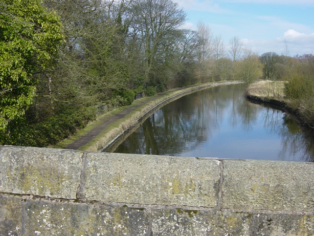
Take the bus the short distance from the bus station to Wigan Infirmary, the 362 service to Chorley departs every fifteen minutes and takes away what would be the boring section of the walk. From the bus stop on Wigan Lane cross the road and proceed past the plantation gates SD 58500 07160, Marylebone, Leyland Mill Lane and the Cherry Gardens public house, turn right at Woodfield Primary School into Brock Mill Lane SD 58250 07670 and follow the road which later becomes a track down to the river at the site of the old Blue Printers factory, now a housing estate. Take care at the bottom of the hill, it can be very muddy in wet weather, cross the footbridge over the river, continue to the end of the path and emerge onto Wingates Lane SD 58270 08200. Turn left and continue straight ahead into Pendlebury Lane the continuation of Wingates Lane passing the entrance to Sennicar Lane on the right, follow the track along the valley and up through the fields to the canal SD 58800 09050. Turn left and follow the Lancaster Canal to the bridge at Red Rock SD 58480 09900, leaving the towpath here cross Red Rock Lane and continue straight ahead into Arley Lane the access road to Wigan Golf Club.
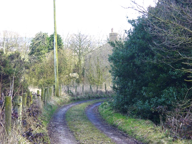
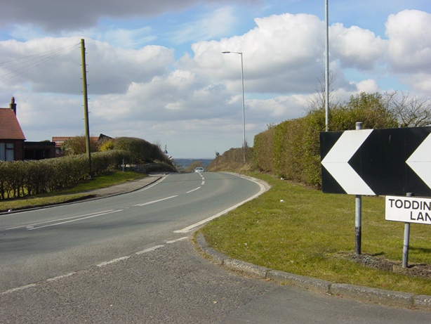
After crossing the bridge over the disused railway line follow the road round to the right past the entrance to Water Works Farm and some of the fairways of the golf course, at this point over to the right you can see the Victorian aqueduct carrying the canal over the trackbed of the railway. Continue along Arley Lane past the entrance to the golf club over the canal bridge SD 58934 10668 and pass Abbey Farm on the right. Further along the lane crosses the disused railway again, continue ahead ignoring any footpaths going off to the right and left, round a left and right hand bend where the lane becomes Blundell Lane, to its junction with Toddington Lane at Little Scotland Blackrod SD 60648 10684. Turn right, walk along Toddington Lane for a short distance and take the second footpath on the left marked "Rotary Way" SD 60681 10408. At the junction near Copperas House SD 60938 10359 turn right and follow the path across the field, where the path divides take the path to the left and follow it to Freezeland Farm negotiating a couple of stiles on the way SD 60881 10246 and SD 60954 10147. At Freezeland Farm SD 61260 09750 turn right and follow the farm track past the bramble covered site of the shaft of the old Freezeland Colliery towards its junction with Toddington Lane, at the bend in the track climb over the stile SD 60948 09549 into the field on the left and climb up to enter Haigh Road in Haigh Village via the footpath through Toddington Farm yard SD 60850 09400.
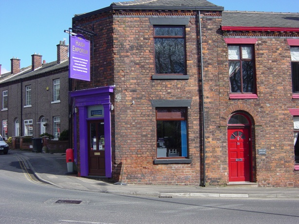
Continue along Haigh Road SD 60783 09275 to the junction at St David's church SD 60670 09000, here depending on the time of day you can pause for refreshment either at the Balcarres Arms or the recently established Haigh Emporium in the old Post Office where the coffee and ice cream come highly recommended. When you are ready to continue take the signposted bridleway alongside the churchyard and continue past a new plantation on the left to a junction where several paths intersect SD 60400 07940. This is the site of the old Lindsay and Crawford Collieries, from here the walk follows the old mineral railway trackbed which used to connect this site with the old Alexandra Colliery at Whelley. It's not very clear where the path along the trackbed begins, the path straight ahead leads on to Higher Lane but if you go into the field on the left and turn immediately right you should be able to see it. The first part of the path can be a quagmire in wet weather, if this is the case take the right hand path to Higher Lane turn left over the bridge and look for a gap in the fence to gain access to the old mineral line path SD 60304 07872. Continue down this path to Shenfield Bridge on the Lancaster Canal and turn right along the towpath SD 59930 07449.
Immediately on the right on the other side of the canal is the remains of the old Bridge Pit and a little further along the walled shaft of the old Dairy Pit, both dating back to the early days of mining in the eighteenth century. At one time the two pit shafts were connected and designated upcast and downcast for ventilation purposes. The upcast had a furnace at the bottom of the shaft to draw fresh air into the mine via the downcast and discharge foul air to the atmosphere via its own shaft. A very ingenious system but I suppose not without its problems especially if there was gas in the mine. Continue along the towpath to the main driveway through Haigh Plantations SD 59500 07900, ascend the steps at the side of the lattice bridge near the site of the old Wigan Rowing Club, turn left to follow the road back to the main gates on Wigan Lane SD 58500 07160 and take the bus back to the bus station or walk if you still have the energy, it is downhill.
Palfreyman - 14th March 2010